


Stoke On Trent - Sheet 110
Publisher: Ordnance Survey
Format: Paperback
ISBN: none
Stoke-on-Trent – Sheet 110 (1947) – Ordnance Survey
Ordnance Survey | New Popular Edition | ISBN: None
Condition: Good | Sold by Crappy Old Books
Stoke-on-Trent. The beating heart of the Potteries, where generations of industrious people devoted themselves to transforming lumps of Staffordshire clay into elegant dinner services, decorative ornaments and the sort of respectable household crockery that would eventually end up gathering dust in grandmother’s display cabinet. A city built upon coal, clay, iron, smoke and the extraordinary British conviction that the world could never possess too many teapots.
Welcome to Stoke-on-Trent – Sheet 110, a magnificent survivor from the Ordnance Survey’s New Popular Edition One-Inch Map of England and Wales, first published in 1947, when Britain was emerging from the Second World War, rationing remained an everyday inconvenience and the nation’s industrial heartlands were preparing for another period of economic transformation.
At the traditional scale of one inch to one mile, this map captures Stoke-on-Trent and a considerable stretch of the surrounding Staffordshire and Cheshire countryside, including places such as Crewe, Congleton, Kidsgrove, Newcastle-under-Lyme and Uttoxeter.
It is a wonderfully detailed portrait of an area where industrial towns, agricultural landscapes, railways, canals and ancient roads existed in close proximity, creating the complicated geographical patchwork that characterised much of industrial Britain.
Stoke itself was no ordinary town. Formed from the famous Six Towns of the Potteries, it became internationally renowned for ceramic manufacturing, producing everything from inexpensive everyday crockery to the finest examples of British pottery and porcelain.
The surrounding landscape reflected centuries of industrial activity. Coal mines, factories, transport routes and expanding settlements demonstrated the enormous importance of the Midlands to Britain’s manufacturing economy.
But 1947 was a particularly interesting moment to capture this landscape.
The war had ended barely two years earlier, reconstruction was underway, and the country was confronting the difficult business of rebuilding its economy while maintaining an industrial infrastructure that had been pushed to its limits. New roads, housing developments and changing patterns of employment would gradually transform the region during the following decades.
For local historians, genealogists and enthusiasts of industrial heritage, this vintage map offers a fascinating opportunity to examine the geography of the Potteries before many of those changes occurred.
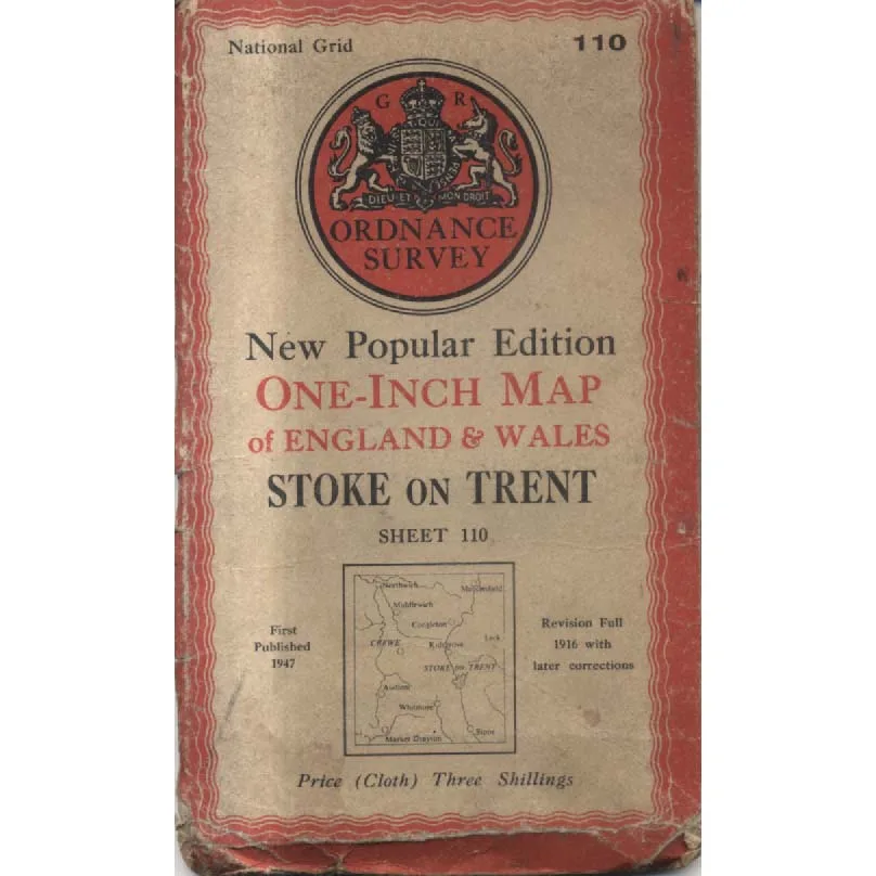
The map’s wonderfully evocative New Popular Edition cover, complete with its royal coat of arms, decorative red border and original price of three shillings for the cloth edition, is itself a charming artefact of post-war British publishing.
Interestingly, the cover also records that the underlying revision was completed in 1916 with later corrections, illustrating how Ordnance Survey mapping could preserve geographical information gathered over several decades. It is therefore a particularly intriguing historical document rather than a definitive picture of every feature as it stood in 1947.
This 1947 Ordnance Survey Sheet 110, offered in Good condition by Crappy Old Books, is an appealing acquisition for collectors of vintage maps, Staffordshire historians, railway enthusiasts and anyone interested in the industrial landscapes of Britain’s past.
A delightful piece of cartographic history, preserving the roads, settlements and geographical character of the Potteries and surrounding countryside during a period of enormous national change.
And a reminder that before satellite navigation and electronic mapping, finding your way around Stoke-on-Trent required a paper map, a good sense of direction and possibly a local resident willing to explain which of the Six Towns you had accidentally wandered into.
At least if you got completely lost, there was a reasonable chance of finding somewhere that made teapots.
Keep browsing: See more Maps books Other books by Ordnance Survey
